Showing posts with label MONUMENTS AND LANDMARKS. Show all posts

Tuesday, April 16, 2013

Welcome Landmarks of Davao City

Welcome Landmark to Davao City along BUDA Highway in Barangay Baganihan in Marilog District.

These are images of beautifully designed Welcome Landmarks in Davao City strategically located in different parts of the city as they proudly greet and welcome motorists and visitors entering from other cities and provinces in Mindanao.

Sculptures of the Davao Eagle, the "King of Philippine Skies"and the natives of Mindanao
 along BUDA Highwayin Barangay Baganihan, Marilog District of Davao City
 welcoming visitors coming from Bukidnon.
Welcome Landmark in Toril featuring "Durian and Kalabaw" welcoming
guests from General Santos City.
 

Welcome Landmark in Lasang featuring the "Waling-Waling"
the"Queen of Orchids" welcoming motorists coming from Tagum City.

Many thanks to JM of SSC-Davao for the photos.

Monday, September 24, 2012

Freedom Park in Davao City


In the Philippines, local governments are mandated to designate a Freedom Park where people can exercise their constitutional freedom of speech and expression in a peaceful gathering, rallies or protests; a venue where they can ventilate and be heard of the various issues and concerns of the city that confront them. 

Millennium Park

In Davao City, Freedom Park consists of two parks: the Millennium Park and the Clifford Park. The Millennium Park is located in the center island along the stretch of Roxas Avenue across Ateneo de Davao University, while  Clifford Park is the wide and spacious intersection of Claro M. Recto Street (old Claveria Street) and Roxas Avenue, fronting Ateneo de Davao and Marco Polo Hotel. Clifford Park was named in honor of a United States Army commander who was killed in action during the liberation of Davao in World War II.  

Clifford Park

Clifford Park in Davao City

Clifford Park

This wide and spacious corner of Claro M. Recto Street (old Claveria Street) and Roxas Avenue, fronting, in this photo, Ateneo de Davao, and Marco Polo Hotel, from where this photo was taken, is called Clifford Park. It was named in honor of a United States Army commander who was killed in action during the liberation of Davao in World War II.  

The Park is one of the two parks that consist the Freedom Park in the city; the other one is called Millennium Park which is located in the center island along the stretch of Roxas Avenue across Ateneo de Davao University.

In the Philippines, local governments are mandated to designate a Freedom Park where people can exercise their freedom of speech and expression in a peaceful gathering, rallies or protests; a venue where they can ventilate and be heard of the various issues and concerns of the city that confront them. 

Wednesday, September 19, 2012

Millennium Park in Davao City

Millennium Park 

This is the Millennium Park in Davao City. It is located along the stretch of Roxas Avenue right across Ateneo de Davao University. The Park is one of the two parks that consist the Freedom Park in the city; the other one is at the corners of Claro M. Recto Street (old Claveria Street) and Roxas Avenue, fronting Marco Polo Hotel and City Triangle, called the Clifford Park, which was named in honor of a United States Army commander who was killed in action during the liberation of Davao in World War II.  

In the Philippines, local governments are mandated to designate a Freedom Park where people can exercise their freedom of speech and expression in a peaceful gathering, rallies or protests; a venue where they can ventilate and be heard of the various issues and concerns of the city that confront them.

Millennium Park with Marco Polo Hotel in the background
Millennium Park with Ateneo de Davao at the right

A bust of an Indonesian hero at the Millennium Park

Thursday, August 23, 2012

Quezón Park

Quezon Park in Davao City

This particular post now completes the three historical parks situated within the center of religious and political power where the legislative and executive branches of the local government of Davao City form a right triangle with the Archdiocese of Davao at the center; the other two landmark parks are: the Osmeña Park (formerly Plaza de Oyanguren), and the Rizal Park.

Quezon Park was constructed in honor and memory of Manuel Luis Quezón y Molina, (born August 19, 1878 and died August 1, 1944), who served as president of the Commonwealth of the Philippines from November 15, 1935 to August 1, 1944. Quezón was the second president of the Republic, after Emilio Aguinaldo (1897–1901).

Manuel L. Quezon

The Park is situated right in front of the City Hall of Davao, and a few meters east of Rizal Park, and the Sangguniang Panglungsod ng Dabaw along the historic San Pedro Street - the oldest street in the Davao City. It has also been the center stage where every significant event in the history and life of Davao City and the Davaoeños unfolds. It is one of the chief venues for all our major festivals and celebrations in the city such as the Araw ng Dabaw and the Kadayawan Festival.

Inside the Park are two beautifully handcrafted concrete Durians, a landscaped gardens and a water fountain. 

Water Fountain

Concrete Durian

In  Davao City, it is not a major citywide event if it does not happen in San Pedro Street where the Quezon Park is situated. It is where political rallies and religious fellowships are held, free concerts and where street food fiestas are celebrated. It is Davao City’s Kilometer Zero, after all.

View of Quezon Park facing the historic San Pedro Street

Friday, August 17, 2012

Rizal Park in Davao City


Almost all cities and municipalities in the Philippines have statues of Dr. José Rizal, in honor of the Philippine National Hero. Davao City is no exception. It has its own monument along the historic San Pedro Street, the oldest street in the city.

The Rizal Park is close to the City Hall of Davao City, Quezon Park, about 15 meters west of the Sangguniang Panlungsod ng  Dabaw, San Pedro Cathedral, and Osmeña Park (formerly Plaza de Oyanguren). It has been the center stage where every significant event in the history and life of Davao City and the Davaoeños unfold, such as informal meetings of government staffs about different city concerns, political rallies and religious fellowships are held, government-sponsored  events, free concerts, and street food fiestas are celebrated. The Park is among the chief venues of all major festivals and celebrations in the city, where every Davaoeño has, at one time or another, paraded along the street of San Pedro for the Araw ng Dabaw and danced the "Indak-indak" during Kadayawan Festival. It is located at the seat of religious and  political power where the legislative and executive branches of local government form a right triangle with the Archdiocese of Davao at the center. After all, the area where the Rizal Park is situated is Davao City’s Kilometer Zero.

The Rizal Shrine at the park was renovated and officially turned over on March 12, 2009 to the then Mayor Rodrigo Duterte, now Vice-Mayor, by MICO President Yvonne.

Thursday, August 16, 2012

Andrés Bonifacio Rotunda


This is the Andrés Bonifacio Rotunda in Davao City, built in November 30, 1961 in honor of Andrés Bonifacio y de Castro, on the occasion of the Hero's 98th birthday. 

Known to his comrades-in-arms as "Supremo" (supreme leader), Bonifacio was a revolutionary nationalist and founder of the Katipunan - a secret revolutionary society initiated by him along with Filipino patriots Teodoro Plata, Ladislao Diwa, and others in Manila in July 7, 1892, whose primary aim was to gain independence from Spanish colonial rule through revolution, but was eventually discovered by the Spaniards in 1896 which led to the outbreak of the Philippine Revolution. Bonifacio was born on November 30, 1863 and died a hero on May 10, 1897 at age 34.


How to get to the Andrés Bonifacio Rotunda

The Rotunda, also known as "Handog ng Kapisanang Bayan at Wika sa Lunsod ng Dabaw," is situated at the downtown city proper of Davao, walking distance to several famous landmarks in the city as Museo Dabawenyo, Osmeña Park, Sangguniang Panlungsod ng DabawCity Hall of Davao, San Pedro Cathedral, Rizal Park, and Quezon Park. It is bounded to the North by Claro M. Recto Avenue, Father Selga Street to the West, and to the East is Pichon Street. It is easily accessible by any means of transportation anywhere in the city.

Saturday, July 28, 2012

Commemorative Monument of Peace and Unity


The Commemorative Monument of Peace and Unity, or the Centennial Monument of Peace and Unity is an important fixture and landmark in the City of Davao as the monument celebrates the peaceful and harmonious coexistence between the indigenous inhabitants and migrant people of Davao City in the last 100 years. It was unveiled during the celebration of the 100th year of Philippine Independence in June 12, 1998.

The Monument artfully depicts the men and women of the different indigenous peoples in native outfits as well as the migrants of Davao City in a noble gesture of jointly raising their hands as a symbol of peace and unity as the three doves are released from the hands of a woman dressed in traditional Baro at Saya - depicting our Mother Philippines. It is a work of art of Kublai Milan, a famous artist and prolific sculptor of Davao City.

The Monument's Marker

The Marker reads:

The Commemorative Monument of Peace and Unity

This Centennial Monument of Peace and Unity is dedicated to the people of 
Davao. The different natives of Lumads of Davao. The Muslims who came 
and settled along Davao's coast and the Christians led by Don Jose
Oyanguren who came in 1848 to establish the first Christian settlement here.

They, People of diverse cultures and from different places who came and
lived together as one, made Davao what it is today. We, their descendants,
beneficiaries and present Davaoeños, honor them for their legacy of unity
and peace . . . their most valuable legacy to us.

Unveiled June 12, 1998 in celebration of the Centennial Year
of the Philippine Independence (1898 - 1998).


Davao City's Commemorative Monument of Peace and Unity

How to get to the Commemorative Monument of Peace and Unity

This important landmark is situated infront of the Sangguniang Panlungsod ng Dabaw, facing the San Pedro Cathedral along San Pedro Street in downtown area. It is easily accessible by private or any public transportation which is readily available anywhere in the city.

Sunday, June 17, 2012

Ohta Kyozaburo Monument


Ohta Kyozaburo Monument is an important historical structure erected in 1926 in Bago Oshiro in Calinan District, Davao City in honor of Ohta Kyozaburo, a Japanese entrepreneur, who, shortly after the turn of the 20th century, migrated to Davao City and cultivated vast lands around the shores of Davao Gulf into Abacá and coconut plantations, and who is considered by local historians as the "Father of Davao Development."

Born in Hyogo, Japan in February 1876, Ohta Kyozaburo established the Ohta Development Company, the first Japanese Abacá plantation company in the Philippines in May 3, 1907. He also established several other companies such as Mintal Plantation Company, Riverside Plantation Company, Talomo River Plantation Company, Guianga Plantation Company, and was instrumental in Davao's economic growth and prosperity. He died in Kyoto, Japan in October 31, 1917 at age 41.

Left photo: Abaca Plantation In Davao, and right photo: the obelisk in honor of Ohta Kyozaburo

The first wave of Japanese plantation workers set foot in 1903 (three years after the American forces landed in 1900) and, immediately thereafter, built their own schools, hospitals and road networks, published their own newspapers, erected an embassy, and a Shinto Shrine. During this time, private farm ownership and large-scale business interests such as copra, timber, fishing, and import-export trading by the Japanese had flourished in Davao region. Transportation and communication facilities had also much improved, and over time, the locals learned from the Japanese the modern techniques of cultivation. Hence, agriculture became the main lifeblood of Davao which paved the way for the province’s economic growth and prosperity.

The Guianga Municipal District, centered around Mintal in Davao, known as "Little Tokyo," became the center of trade and settlement for Japanese expatriates working for the Ohta Development Corporation and the Furukawa Plantation Company. By the 1930’s, Davao was completely under the control of the Japanese and their economic clout made them politically influential as their population grew to 17, 900 by 1939. During this period, the then undivided province of Davao became the world's biggest producer of Abaca with the entire industry practically under Japanese control. Despite laws restricting foreign ownership of land, the Japanese managed to become the largest plantation owners in Davao. They were able to achieve this by using dummies to buy land from local landowners and marrying local women, particularly with datu lineage.
As Japan was becoming a world power, having defeated Russia in 1904, and annexed Korea in 1910 and Manchuria in 1931, doubts as to the real intentions of the Japanese haunted the entire country. In the 1934 Constitutional Convention, Davao delegate, Pantaleon Pelayo Sr., strongly denounced total control of Davao by the Japanese and their unlimited acquisition of land. 

Due to the increasing influence of the Japanese in the trade and economy of the region, on March 16, 1936, Davao Congressman Romualdo C. Quimpo filed House Bill no. 609 calling for the creation of Davao as a chartered city. The bill sought to break the control of the Japanese and was subsequently passed and signed into law by President Manuel L. Quezon as Commonwealth Act No. 51, formally creating the City of Davao from the Town of Davao (Mayo) and the Guianga District. The Act stipulated for the appointment of its local officials by the President of the Philippines, instead of being elected, thus entrenching Japanese power in Davao. It also made Davao City the provincial capital of the then undivided Davao Province, thus, making it the largest city in the world with a territory of 2,244 square kilometers or 244,400 hectares. 

The Obelisk and the Japanese Pyramid

However, World War II erupted and, on December 8, 1941, the Japanese planes bombed the city, and eventually occupied Davao in 1942. By 1945, the American troops and the Philippine Commonwealth forces had liberated Davao City from Japanese occupation. And whatever progress the local and Japanese migrants made in this "Little Tokyo" in Guianga Municipal District in Mintal was destroyed during the war. The only remnants include the Obelisk built in 1926 with the inscription:

"KS Ohta, who believed in Davao and helped it grow." 

Beside the Obelisk is the base of the Japanese pyramidal structure honoring the memories of the directors of Ohta’s plantation company. The area used to be part of a ten thousand hectare Abaca plantation which included an advanced irrigation canal system. 

Today, the irrigation canal is being utilized by the National Power Corporation. The Obelisk, the Japanese Pyramid, and the irrigation canal are located on the grounds of the Mintal Public Elementary School which was the former site of one of the biggest Japanese Primary Schools built in Davao in 1924, and which was once used as the Japanese Headquarter during WWII..

Other markers and obelisks of Japanese nationals who died as residents of Davao during the war can still be seen in and around Mintal, Toril, and Calinan. In the month of August, Japanese tourists would usually come to these places to visit and honor their dead - an important Japanese tradition. They particularly visit Mintal which is the site of the Ohta Corporation, once the biggest prewar Abacá production company that had ruled the industry for over four decades. Local government officials led by "Little Tokyo": of Prewar Philippines, and the deputy mayor, are busy at this time preparing for the coming of their Japanese guests.

On May 11, 2009, a Peace Pole was planted right beside the marker by the World Peace Prayer Society. 

Friday, October 14, 2011

Magsaysay Park


Magsaysay Park in Davao City is a beautifully landscaped public park that sits on a huge sprawling expanse that faces the clear blue waters of the Gulf of Davao with the Samal Island in the backdrop. While there are many parks in Davao City, this park remains the favorite of the locals and is frequented by foreign tourists, families and friends alike for an afternoon of leisurely stroll, or simply hanging-out. This city landmark was built in honor of the most-loved and revered president of the Philippines, Ramon Magsaysay who, in March 17, 1957, died in a plane crash in Mount Manunggal on Cebu Island while en route to Manila. He was the third President of the Republic of the Philippines.

The Life-Size Statue of President Ramon Magsaysay

At the center of the Park is the 25 meter long tri-pillar obelisk-like concrete tower that contains the life-size statue of President Magsaysay which serves as the main marker of the park. The monument was built through the efforts of the Davao Chapter of the Philippine Veterans Legion and was turned over to the City Government of Davao on July 31, 1960.

President Ramon Magsaysay
3rd President of the Republic of the Philippines
(1953 - 1957)

Beloved and revered by the Filipinos, President Ramon Magsaysay is hailed as the "Idol of the Masses" because he was the first among the presidents to open the gates of Malacañan Palace to the common Filipinos. He was born on August 31, 1907.

View of Davao Gulf and Samal Island from the Park

Park Grounds with Benches all over

The Park features several amenities such as an open-air amphitheater which serves, among other things, the regular venue for public discos during Sundays which can accommodate 2,000 persons, a restaurant, a cooling station, several food kiosks, ornamental plants stalls, souvenir and handicraft stalls, a skating rink, a children's playground, an open-air chapel, and a secured parking area which is located south of the park. It also houses several tourism offices: the regional office of the Department of Tourism, the Philippine Tourism Authority, the Department of Foreign Affairs Regional Passport Office, the Overseas Workers Welfare Administration, the Philippine Information Agency, the Samal Island Tourism Estate Project, and the DXRP Radyo ng Bayan.

The Skating Rink

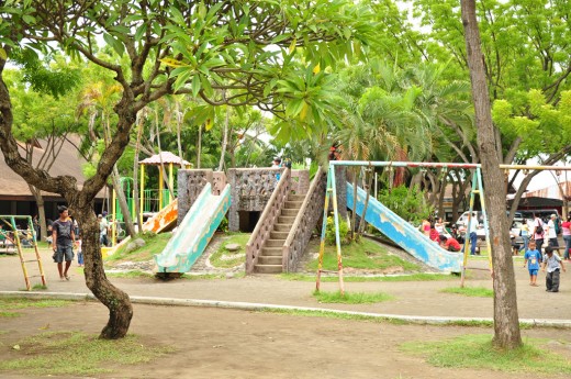
The 200 square meter Children's Playground

Beautifully handcrafted concrete Durian sculpture

The open-air Chapel of Nuestra  Señora  del Pilar

The open-air chapel of the Nuestra Señora del Pilar is located near the sea wall of the Park. Here, many Marian devotees visit the statue to pray for peace, prosperity, and good health. There are several benches and trees that surround the park but the most prominent are those that are along the seawall overlooking the Gulf of Davao.

The Parks houses several government offices

The Pamathalaan Marker

Near the entrance gate of the Park is the Pamathalaan Marker, a symbol of the Mindanaoans commitment to Pamathalaan or God-centered Governance designed by National Artist Napoleon Abueva. The project was funded by the Philippine Tourism Authority.

A sculpture called the "Spirit of the Shaman transformed into a Rock"

Inside the park is a sculpture of the "Spirit of the Shaman transformed into a Rock," a bedrock of solidarity signified during the Kalimudan 2007, the gathering of the Indigenous Peoples from Mindanao and homage to culture bearers, sponsored by the Department of Tourism XI and the National Commission for the Culture and the Arts. This collaborative installation was created by the Mindanao based Lumad artists and the Quebec based Inuit artists with the support of Kalinawa Arts Foundation.

During the Kalimudan

The Park is a popular venue for trade fairs, cultural shows, craft sales, creativity workshops, and public forums. The "Kalimudan: Pinaghiusa sa Mindanao: Mindanao Indigenous People’s  Gathering/Exposition" was a week-long celebration of indigenous knowledge and wisdom which showcased a variety of architecture, and the songs and dances of the 24 indigenous communities all over Mindanao. It was the first kalimudan, or gathering, of its kind in Mindanao. The Park is also frequented by students from the different parts of Mindanao for educational field trips.

One of the features of Kalimudan 

Food Kiosks

There are several food kiosks that serves a variety of grilled meat and seafood, snacks, beverages, and delightful refreshments during late afternoon to evening.

Fishcado Grill and Seafood Restaurant

Fishcado is an open-air seafood restaurant that serves daily a variety of delectable fresh seafood dishes whose ingredients are sourced fresh in the local market.

Magsaysay Fruit Stand

Outside the Magsaysay Park is the Magsaysay Fruit Vendors Association which consists of a long row of fruit stands that sell Durian and other fruits abundant in Davao Region.


How to get to Magsaysay Park

The Park is easily accessible from any point in the city by private or public transportation. It is located in the main street of Leon Garcia Street next to the Sta. Ana Wharf, another historical landmark in Davao City where, in May 1903, the first wave of Japanese workers landed and served as agricultural workers. Those Japanese workers were instrumental in bringing about the development of Abaca industry in Davao. The Park is open daily from 5:00 AM to 9:00 PM
Related Posts Plugin for WordPress, Blogger...